
What's New
Satellite View to allow for better zoom on likely fishing locations.
App Description
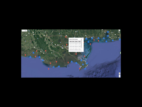
Easy to use tide charts displayed on a Satellite Map for the entire Gulf of Mexico region on a simple to use satellite map. Designed by fishermen and fishing guides.
NO SPAM ADS, SIMPLE TO USE...100% AD FREE.
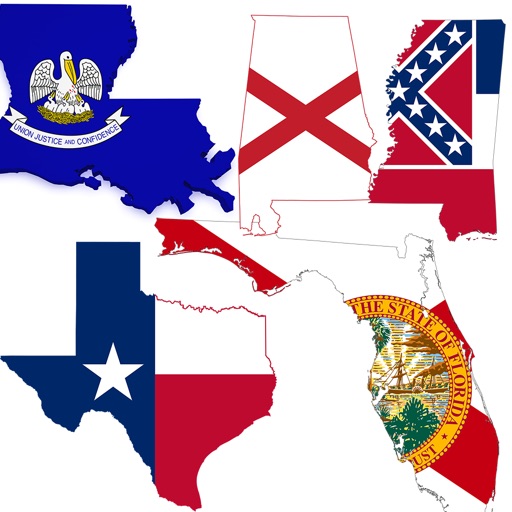
This edition covers the following state's tide charts: Texas tides, Louisiana tides, Mississippi tides, Alabama tides, and Florida tides including the Gulf and East Coast tides of Florida.
Other Features:
Easy to Use, advanced tide graphs allow for you to judge the level of water movement for optimal fishing between high and low tide.
Ability to forecast tides from NOAA by setting date and period for any of the tidal stations for the entire Gulf of Mexico including: Texas, Louisiana, Mississippi, Alabama and Florida.
When GPS is available auto-locate your position and zoom to the map for surrounding NOAA tide stations.
Included is the ability to zoom and view satellite imagery for fishing ground characteristics to compare with tide movement.
Support URL: http://www.nestides.com/contact-us/
Privacy Policy & Terms of Use URL: http://www.progresstechnologies.com/blog/120/privacy-policy-and-terms-of-use/
iPhone Screenshots
(click to enlarge)

iPad Screenshots
(click to enlarge)
App Changes
- June 13, 2014 Initial release
- July 25, 2014 Price decrease: $6.99 -> $4.99
- December 13, 2014 Price decrease: $4.99 -> $2.99
- January 05, 2015 Price increase: $2.99 -> $4.99
- June 13, 2019 New version 3.0
- June 13, 2019 Price increase: $4.99 -> $9.99
- June 14, 2019 Price increase: $4.99 -> $9.99
- June 14, 2019 Price increase: $4.99 -> $9.99
- June 15, 2019 Price increase: $4.99 -> $9.99
- June 15, 2019 Price increase: $4.99 -> $9.99
- June 15, 2019 Price increase: $4.99 -> $9.99
- June 16, 2019 Price increase: $4.99 -> $9.99
Other Apps From Progress Technologies Inc