
What's New
RadarScope TV 2.0.6 addresses a few bugs as well as adds new support for Super Res data from the following radars:
KMXX - Maxwell AFB, Alabama
KEOX - Ft Rucker, Alabama
KHPX - Ft Campbell, Kentucky
KPOE - Ft Polk, Louisiana
KMBX - Minot AFB, North Dakota
KEYX - Edwards AFB, California
KVBX - Vandenberg AFB, California
KVAX - Moody AFB, Georgia
RadarScope TV 2.0 What's New
Updated User Interface
New Products
-Precipitation Depiction: Super Resolution radar reflectivity blended with temperature data to delineate rain/mix/snow, exclusively from the iMapWeather radar data provider.
Overhauled User Interface
-Tap the radar name in the top bar for quick access to Radar Favorites, Radar List/Status, and User Locations.
-New product selection: Flip up the product list from the bottom of the screen to select different products or change tilts with the tilt selector.
-iPhone: Tap the toggle button in left of the top bar to display tool palette (drawing tool, distance tool, image sharing)
Distance tool
-Draw a circle on the map to measure distances between 2 points: automatically locks to radar site, user locations, storm spotters, or storm reports when you tap near one! When measuring from the radar site, displays beam height.
User Locations
-Search for and save/edit points of interest to be displayed on the map. Search by city name, zip, or address.
AllisonHouse Subscribers
-added support for Mesoscale Discussions.
Map Enhancements
-Full screen mode. Tap and hold on the map to reveal as much glorious radar data as possible!
-One finger zoom: double tap and hold on the map, then drag up or down to zoom in and out on the center of the map.
-Improved zoom: zoom in/out on the location between your pinching fingers.
-Inertial scrolling. Finally!
-Compass mode: Display your device's compass heading on the map when Location Services are turned on.
Units
-Choose metric or English units for velocity/distance.
App Description
RadarScope TV is a specialized display application that has been optimized for television use. An iPad 2 or newer model is required to utilize the AirPlay features of the app. Purchase of this app includes rights for broadcast use for one year. RadarScope TV is customized specifically for on-air use. For other uses, see the original RadarScope for iOS, also on the App Store.
RadarScope TV enables meteorologists to view and simulcast to air, native Level 3 and Level 2 super-res NEXRAD radar data as well as severe weather warnings. In addition, this professional app features real-time drawing capabilities and intuitive gesturing along with social integration. The system works remotely, offering on-air talent the ability to mobilize within a studio setting while always having the display on-hand. RadarScope TV runs on iPad 2 and newer models and utilizes AppleTV’s AirPlay for remote features.
Whether you are scanning reflectivity for a mesocyclone's tell-tale hook echo, trying to pinpoint the landfall of a hurricane's eye wall, or looking for small features like velocity couplets in the storm relative radial velocity product, RadarScope TV gives you the power to view true radial NEXRAD weather radar and simultaneously broadcast these images and animations to your viewing audience.
When there are Tornado Warnings (outlined in RED), Severe Thunderstorm Warnings (YELLOW polygons), or Flash Flood Warnings (GREEN polygons) in effect throughout the US, tap the warning button in the top right corner to browse the list of current warnings, view the details, and even zoom to the selected warning on the map.
Pinch or stretch to zoom in and out. Drag your finger around the map to scroll. Tap the radar sweep button in the toolbar to switch radars. Select any NEXRAD or TDWR site, with the rotating radar beam representing each radar's approximate coverage area. Tap the play button to download and animate over the last six images. Display the names of over 25,000 cities and towns on the map as you zoom and scroll. Tap and hold the color legend to see the data values. Meanwhile, RadarScope TV will retrieve and display updated data automatically and intelligently (approximately every 5 to 10 minutes, depending on the radar scan strategy).
You can display data from NOAA's public access web site, our optional commercial feed provided by iMapWeather (the default), or an Allison House subscriber account.
Please visit our web site for more information.
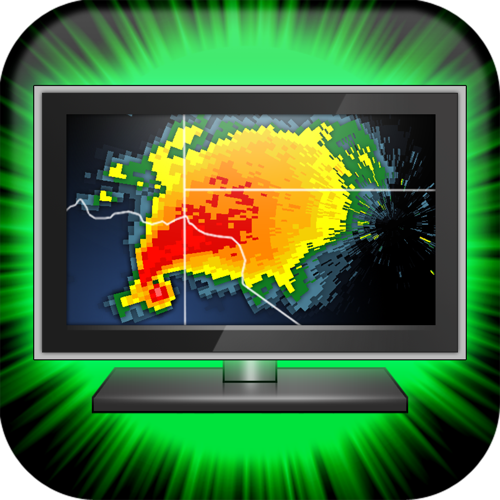
iPad Screenshots
(click to enlarge)


App Changes
- June 13, 2014 Initial release
Other Apps From Base Velocity, LLC