
What's New
fix: app layout on newer iPhone devices
App Description
EasyTrails GPS is the GPS tracker application for your iPhone.
The perfect application for those who are passionate about OUTDOOR ACTIVITIES and TRAVELING, everybody who likes outdoor sports, and not only.
Are you going for a bike or motorcycle ride? Well, EasyTrails GPS will tell you how many miles you traveled, how much time you spent, how high you climbed and many other details. In real-time it will show you the course on a map, comparing it with downloaded tracks and points of interest.
You can import or share all tracks and waypoints, photos and ideas for new journeys with your friends.
Share where you are on Facebook and Twitter through your GPS position, and export your tracks in standard formats, so you can review them on Google Earth, SportTracks and TrailsRunner. Or simply upload them to online services like Garmin Connect, or many others.
It's possible to import tracks by e-mail or Safari (EasyTrails can handle GPX, KML/KMZ and ZIP file formats), or by wi-fi networks, using an improved and easy to use web-based sharing feature.
Calculate routes and let EasyTrails guide you using the new navigation capabilities. You can also let it guide you through previously recorded tracks.
Additionally, EasyTrails GPS can communicate with navigators like Maps, Google Maps, TomTom or Waze (if installed) for more advanced guidance needs.
Load custom cartography, EasyTrails supports KMZ and MBTILES formats.
EasyTrails GPS is easy to use and extremaly accurate. It ensures the maximum duration of battery thanks to the possibility of recording in "StandBy" mode. However, be aware that use of GPS, even in background, will have a significant impact on battery duration.
► For more info, visit our website: www.easytrailsgps.com
NEW FEATURES:
► Heart rate monitoring (paid)
We added the ability to connect to compatible Bluetooth heart rate monitors (such as Polar H6 and H7 devices). Heart rate can be seen in real time from the dashboard.
With the 'Heart rate monitoring' in-app purchase:
- heart rate data will be associated to GPS tracks
- saved tracks will have an extra heart rate chart
- heart rate data will be saved to HealthKit
Additionally, with the 'Colored tracks' in-app purchase, it will be possible to highlight heart rate data directly on the map screen of a recorded track.
OTHER FEATURES:
- Support for many different map types
- Support for different coordinate systems
- Support for user-loaded offline cartography (KMZ and MBTILES)
- Export tracks (single or multiple) in standard formats (GPX, KML/KMZ and CSV), with their associated waypoints and pictures
- Import tracks (GPX and KML/KMZ)
- Import waypoints (GPX and KML/KMZ)
- Resume recording of tracks
- Save waypoints with photos and descriptions
- Navigate to a point of interest
- Sharing via Facebook and Twitter
- Follow a path/track
- Navigate (distance / direction) towards any waypoint
- Navigate (distance / direction) towards any track marker (start / pause / resume / end points)
- Advanced Navigation to a waypoint using any navigation app you may have installed
- Upload tracks to GPSies (http://www.gpsies.com)
- Upload tracks to SportTracks (http://sporttracks.mobi)
- Upload tracks to OpenTrail (http://www.opentrail.us)
- Upload tracks to OkMap (http://www.okmap.org)
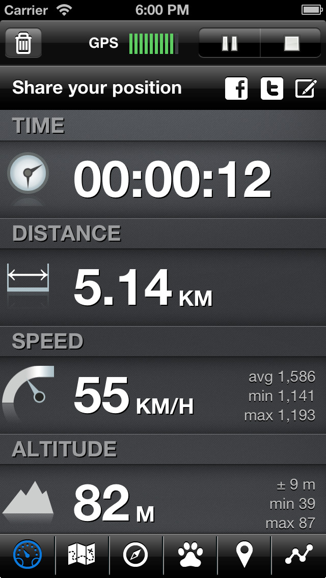
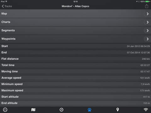
- Real-time visualization of distance, speed, altitude bearing and other data
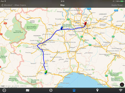
- Map Visualization in different modes: street map, satellite, hybrid, terrain
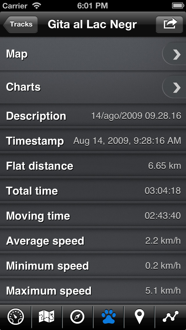
- Charts (elevation profiles, ...)
- Digital Compass
- Heart rate monitoring
- Turn by turn directions
- High battery duration (record in standby)
- Select between metric, imperial and nautical measuring systems
- Intuitive and User Friendly interface
- Lightweight, reliable and accurate
- Doesn't require internet connection
Terms of Use: https://www.apple.com/legal/internet-services/itunes/dev/stdeula/
Privacy Policy: http://www.easytrailsgps.com/wp-content/uploads/2016/05/EasyTrails-GPS-Privacy-Policy.pdf
iPhone Screenshots
(click to enlarge)


iPad Screenshots
(click to enlarge)


App Changes
- September 24, 2011 Price decrease: $3.99 -> $1.99
- September 27, 2011 Price increase: $1.99 -> $3.99
- November 19, 2011 New version 4.3
- December 30, 2011 New version 5.0
- March 31, 2012 New version 6.0
- July 10, 2012 New version 6.1
- September 15, 2012 New version 6.2
- September 20, 2012 New version 6.3
- December 07, 2012 New version 7.0
- April 12, 2013 New version 8.0
- July 03, 2013 New version 8.1
- September 18, 2013 New version 8.2
- October 04, 2013 New version 8.3
- November 07, 2013 New version 8.4
- November 13, 2013 New version 8.5
- May 26, 2014 New version 8.6
- May 31, 2014 New version 8.7
- September 18, 2014 New version 8.8
- October 18, 2014 New version 8.9
- November 03, 2014 New version 8.10
- December 27, 2014 New version 8.11
- March 14, 2015 New version 9.0
- May 10, 2015 New version 9.1
- May 14, 2015 New version 9.3
- July 18, 2015 New version 9.4
- September 19, 2015 New version 9.6
- September 26, 2015 New version 9.7
- January 24, 2016 New version 9.8
- June 23, 2016 New version 9.10
- August 07, 2016 New version 9.11
- November 06, 2016 New version 9.12
- November 11, 2016 New version 9.13
- December 21, 2016 New version 9.14
- December 29, 2016 New version 9.15
- June 14, 2019 New version 9.25
- September 04, 2019 New version 9.26
- October 15, 2019 New version 9.27
- December 10, 2019 New version 10
- December 24, 2019 New version 10.2
- January 21, 2020 New version 10.3
- July 14, 2020 New version 10.5
- August 05, 2021 New version 11.0
- September 16, 2023 New version 11.2
- March 26, 2024 New version 11.4
Other Apps From Zirak Srl