
App Description
Accurate, simple to use Satellite Map based Alabama tide charts of the all NOAA based Alabama tide stations on a simple to use satellite map. Designed by Alabama fishermen and Professional Alabama Fishing Guides.
NO SPAM ADS, SIMPLE TO USE...100% AD FREE.
Other Features:
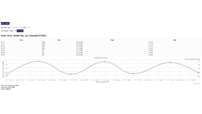
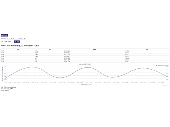
Ability to forecast Alabama tides from NOAA by setting date and period for any of the tidal stations for the entire State of Alabama tide tables.
Excellent support for any issues, questions or new features...simply email: [email protected] and we'll show you how Apple support is meant to be.
Auto-save last location for easy reference to your last tide station the next time you use the tide app.
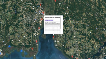
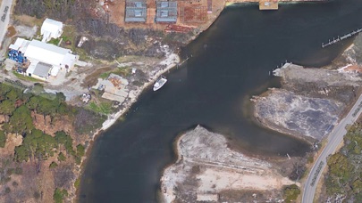
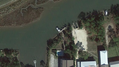
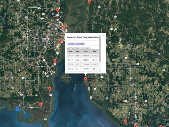
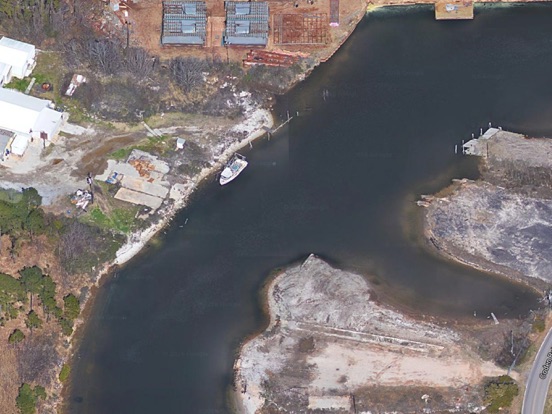
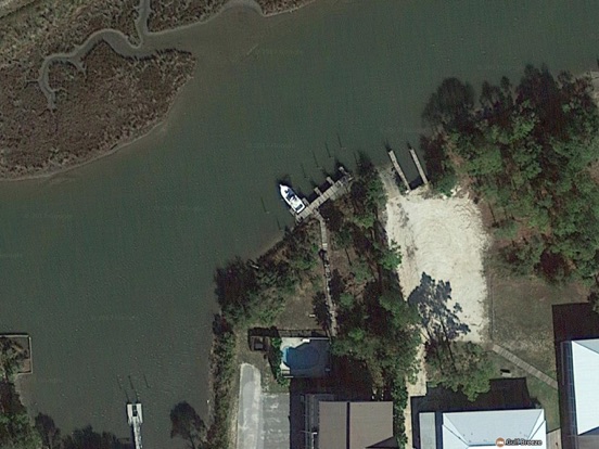
Included is the ability to zoom and view satellite imagery for fishing ground characteristics to compare with tide movement.
Advanced tide graphs allow for you to judge the level of water movement for optimal fishing between high and low tide in Alabama between tide stations so you can follow the tide flow for the entire day.
Recent Feedback:
"NesTides ability to display tide predictions and actual tidal flow graphs allow me to extend fishing trips by following different tide station tide charts and moving with the tide flow. The satellite view allows me to explore and discover new fishing grounds I never knew existed. Absolutely the best fishing software tool I have ever used. ," said USCG Captain Mike K.
Alabama Tide Chart stations include (partial list see website for full list):
Alabama Point,Mobile Point (Fort Morgan),Gulf Shores, ICWW,Bon Secour, Bon Secour River,DAUPHIN ISLAND,East Fowl River, Hwy 193 Bridge,West Fowl River, Hwy 188 bridge,Point Clear, Mobile Bay,Dog River Bridge,Coast Guard Sector Mobile,Meaher State Park, Mobile Bay,MOBILE, Mobile River (State Dock),William Brooks Park, Chichasaw Creek,Lower Hall Landing, Tensaw River,Bayou La Batre, Mississippi Sound,Bayou LaBatre Bridge,Grand Bay NERR, Mississippi Sound,Point of Pines, Bayou Cumbest,Hollingsworth Point, Davis Bayou,Petit Bois Island, Mississippi Sound,Ship Island, Mississippi Sound,Horn Island, Mississippi Sound,Dock E, Port of Pascagoula,Pascagoula, Mississippi Sound,Graveline Bayou Entrance,Gulfport Harbor, Mississippi Sound,Biloxi (Cadet Point), Biloxi Bay,Turkey Creek, Bernard Bayou,Handsboro Bridge, Bernard Bayou,Cat Island,Pass Christian Yacht Club, Mississippi Sound,Wolf River, Henderson Avenue bridge,St. Louis Bay entrance,Waveland,Pearlington, Pearl River
iPhone Screenshots
(click to enlarge)
iPad Screenshots
(click to enlarge)
App Changes
- January 20, 2018 Initial release
- January 20, 2018 Price increase: $0.99 -> $4.99
- June 14, 2019 Price increase: $4.99 -> $9.99
- June 14, 2019 Price increase: $4.99 -> $9.99
- June 15, 2019 Price increase: $4.99 -> $9.99
- June 15, 2019 Price increase: $4.99 -> $9.99
- June 15, 2019 Price increase: $4.99 -> $9.99
- June 16, 2019 Price increase: $4.99 -> $9.99
Other Apps From Progress Technologies Inc