
App Description
Accurate, simple to use Satellite Map based Connecticut tide charts of the all NOAA based Connecticut tide stations on a simple to use satellite map. Designed by Connecticut fishermen and Professional Connecticut Fishing Guides.
NO SPAM ADS, SIMPLE TO USE...100% AD FREE.
Other Features:
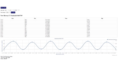
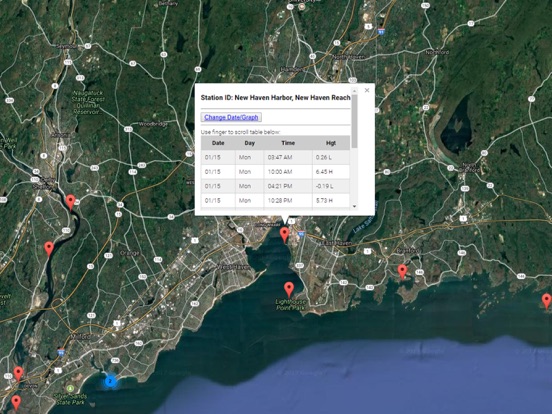
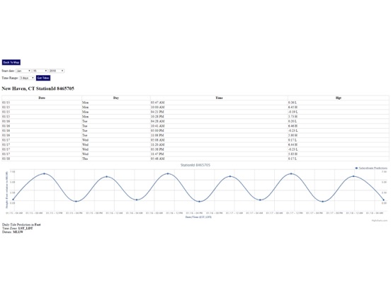
Ability to forecast Connecticut tides from NOAA by setting date and period for any of the tidal stations for the entire State of Connecticut tide tables.
Excellent support for any issues, questions or new features...simply email: [email protected] and we'll show you how Apple support is meant to be.
Auto-save last location for easy reference to your last tide station the next time you use the tide app.
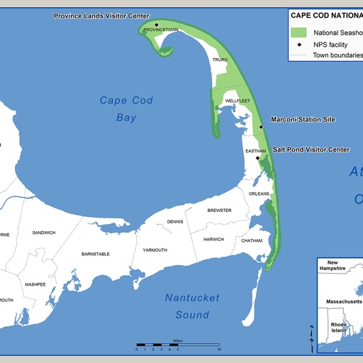
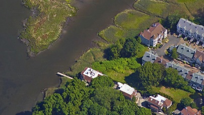
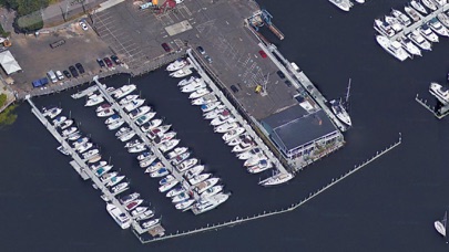
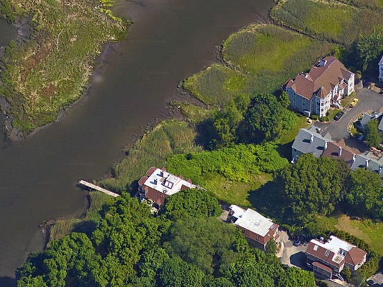
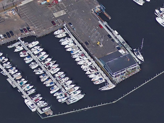
Included is the ability to zoom and view satellite imagery for fishing ground characteristics to compare with tide movement.
Advanced tide graphs allow for you to judge the level of water movement for optimal fishing between high and low tide in Connecticut between tide stations so you can follow the tide flow for the entire day.
Recent Feedback:
"NesTides ability to display tide predictions and actual tidal flow graphs allow me to extend fishing trips by following different tide station tide charts and moving with the tide flow. The satellite view allows me to explore and discover new fishing grounds I never knew existed. Absolutely the best fishing software tool I have ever used. ," said USCG Captain Mike K.
Connecticut Tide Chart stations include (partial list see website for full list):
WEST MYSTIC, MYSTIC RIVER,Silver Eel Pond, Fishers Island, N.Y.,NEW LONDON, State Pier,Yale boathouse,Norwich,Niantic, Niantic River,Saybrook Jetty,Saybrook Point,Lyme, highway bridge,Essex,Hadlyme,Tylerville,Haddam,Higganum Creek,Maromas,Middletown,Rocky Hill,South Hartford,Hartford,Westbrook, Duck Island Roads,Clinton Harbor,Madison,Guilford Harbor,Sachem Head,Branford, Branford River,Lighthouse Point, New Haven Harbor,New Haven Harbor, New Haven Reach,Gulf Beach,Milford Harbor,Sniffens Point,Stratford, I-95 bridge,Long Hill,Shelton,BRIDGEPORT,Black Rock Harbor,Southport, Southport Harbor,SAUGATUCK, SAUGATUCK RIVER,South Norwalk,Rowayton, Fivemile River,Long Neck Point,Stamford,Cos Cob Harbor
iPhone Screenshots
(click to enlarge)

iPad Screenshots
(click to enlarge)
App Changes
- January 17, 2018 Initial release
- June 13, 2019 Price increase: $0.99 -> $9.99
- June 13, 2019 Price increase: $0.99 -> $9.99
- June 14, 2019 Price increase: $0.99 -> $9.99
- June 14, 2019 Price increase: $0.99 -> $9.99
- June 15, 2019 Price increase: $0.99 -> $9.99
- June 15, 2019 Price increase: $0.99 -> $9.99
- June 16, 2019 Price increase: $0.99 -> $9.99
Other Apps From Progress Technologies Inc