
What's New
This app has been updated by Apple to use the latest Apple signing certificate.
App Description
Accurate, simple to use Satellite Map based Hawaii tide charts of the all NOAA based Hawaii tide stations on a simple to use satellite map. Designed by Hawaii fishermen and Professional Hawaii Fishing Guides.
NO SPAM ADS, SIMPLE TO USE...100% AD FREE.
Other Features:
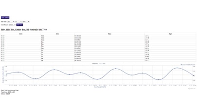
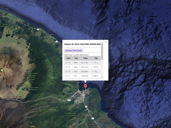
Ability to forecast Hawaii tides from NOAA by setting date and period for any of the tidal stations for the entire State of Hawaii tide tables.
Excellent support for any issues, questions or new features...simply email: [email protected] and we'll show you how Apple support is meant to be.
Auto-save last location for easy reference to your last tide station the next time you use the tide app.
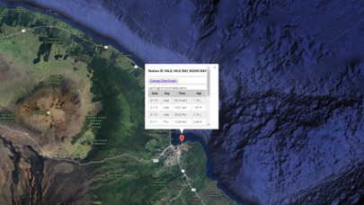
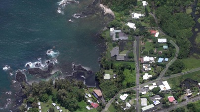
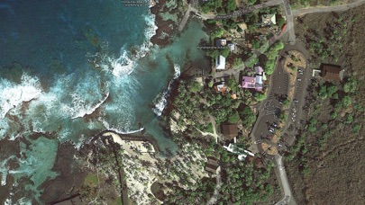
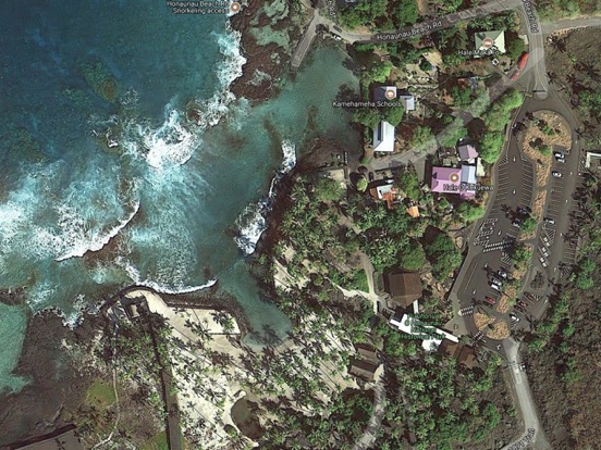
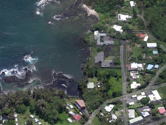
Included is the ability to zoom and view satellite imagery for fishing ground characteristics to compare with tide movement.
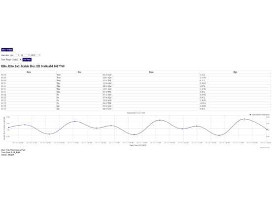
Advanced tide graphs allow for you to judge the level of water movement for optimal fishing between high and low tide in Hawaii between tide stations so you can follow the tide flow for the entire day.
Recent Feedback:
"NesTides ability to display tide predictions and actual tidal flow graphs allow me to extend fishing trips by following different tide station tide charts and moving with the tide flow. The satellite view allows me to explore and discover new fishing grounds I never knew existed. Absolutely the best fishing software tool I have ever used. ," said USCG Captain Mike K.
Hawaii Tide Chart stations include (partial list see website for full list):
Hawaiin Islands, SAND ISLAND, MIDWAY ISLANDS, Laysan Island, East Island, French Frigate Shoals, Nonopapa, Niihau Island, Kauai Island, Waimea Bay, Port Allen, Hanapepe Bay, NAWILIWILI, Hanamaulu Bay, Hanalei Bay, Oahu Island, Haleiwa, Waialua Bay, Waianae, Pearl Harbor Entrance, Bishop Point, Pearl Harbor, Ford Island Ferry, HONOLULU, Hanauma Bay, Waimanalo, MOKU O LOE, Waikane, Kaneohe Bay, Laie Bay, Molokai Island, Kolo, Kaunakakai, Kamalo Harbor, Pukoo Harbor, Kaumalapau, Lanai Island, Kahoolawe Island, Kuheia Bay, Smuggler Cove, Maui Island, KAHULUI, Hana, Makena, Kihei, Maalaea Bay, Lahaina, Hawaii Island, Mahukona, Kawaihae, Kailua Kona, Napoopoo, Kealakekua Bay, Honuapo, HILO, JOHNSTON ATOLL, Palmyra Island, Howland Island, Easter Island (Chile)
iPhone Screenshots
(click to enlarge)
iPad Screenshots
(click to enlarge)
App Changes
- January 10, 2018 Initial release
- January 11, 2018 Price increase: $0.99 -> $4.99
- January 11, 2018 Price decrease: $4.99 -> $0.99
- January 11, 2018 Price increase: $0.99 -> $4.99
- January 11, 2018 Price decrease: $4.99 -> $0.99
- January 11, 2018 Price increase: $0.99 -> $4.99
- January 11, 2018 Price decrease: $4.99 -> $0.99
- January 11, 2018 Price increase: $0.99 -> $4.99
- January 11, 2018 Price decrease: $4.99 -> $0.99
- January 11, 2018 Price increase: $0.99 -> $4.99
- January 11, 2018 Price decrease: $4.99 -> $0.99
- January 11, 2018 Price increase: $0.99 -> $4.99
- June 14, 2019 Price increase: $4.99 -> $9.99
- June 14, 2019 Price increase: $4.99 -> $9.99
- June 15, 2019 Price increase: $4.99 -> $9.99
- June 15, 2019 Price increase: $4.99 -> $9.99
- June 15, 2019 Price increase: $4.99 -> $9.99
- June 16, 2019 Price increase: $4.99 -> $9.99
Other Apps From Progress Technologies Inc