


What's New
Updated login experience
Minor bug fixes and performance improvements
App Description
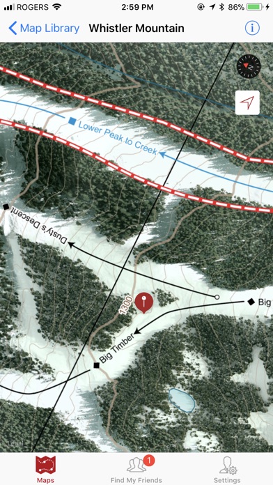
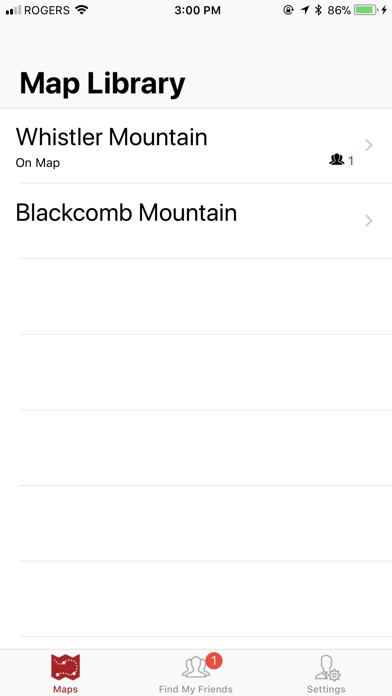
ULLR Adventure Maps is an award-winning app that provides highly detailed maps of Whistler and Blackcomb Mountains as well as surrounding areas. ULLR Maps are custom designed from the ground up over a process that takes hundreds of hours, to provide adventurers with the most up-to-date, beautiful, precision maps available for use on their mobile devices.
The app features:
-Highly detailed winter and summer maps
-Run / Feature database including over 800+ on mountain entries
-Run / Feature search.
-Leaderboards (Global, Friends and Ladder)
-Map specific information screen that includes links to weather, avalanche forecasts, WB webcams and grooming / lift status’.
-GPS location pinpointing
-GPS tracking
-WGS 84 Coordinate lookup
-The ability to find and track your friends
-Pin dropping/editing
-Safety screen that includes your location, elevation, and telephone numbers for your local rescue/first aid service.
Feature Details:
- The GPS location pinpointing can help you guide yourself back in safety if you are unsure of where you are. The GPS pinpointing feature only uses GPS and not a data connection.
- GPS tracking will show you where you travelled throughout the day.
- Coordinate lookup allows users to search for coordinates within the map bounds in WGS84, decimal degrees (professional feature).
- The Find My Friends feature allows users to track each other in near real-time. With the ability to locate your friends and family while they are skiing, biking or hiking, you needn't worry about getting separated again. This feature requires a data connection to function.
- With pin dropping, you can mark locations that you wish to return to or maybe that you plan to explore later.
- The run / feature database is a database that contains over 800 entries about places located on Whistler and Blackcomb Mountains and will soon be expanding to cover our Spearhead Traverse map. Users can search for a feature, select their choice, learn about the run/feature and then quickly located the feature on the map.
- Leaderboards allow users to automatically upload their GPS tracks to global, friends and ladder leaderboards. Metrics such as vertical gained/lost, average speed, time recording, and distance travelled are all recorded. Plans to include prizing soon.
- Updated emergency screen that includes a map showing the user’s physical location, their location in WGS 84, decimal degrees, their estimated altitude as well as the map-dependent telephone number for the local rescue organization.
- Map dependent information links. These information links provide access to much needed information such as weather, avalanche forecast and hazard ratings, grooming and lift status as well as webcams.
- We’ve revamped our GPS recording layout UI, making it easier to recognize active recording. We’ve also included active recording time.
iPhone Screenshots
(click to enlarge)

App Changes
- November 21, 2017 Initial release
- June 14, 2019 New version 3.0.1
- June 14, 2019 Price decrease: $10.99 -> FREE!
- June 16, 2019 Price decrease: $10.99 -> FREE!
- August 16, 2019 New version 3.1.0
- December 17, 2019 New version 3.3.0
- July 14, 2020 New version 3.4.0
- December 09, 2020 New version 3.5.0
- May 06, 2021 New version 3.5.1
- September 16, 2023 New version 3.6.0