
What's New
- Performance in route/track drawing algorithm.
- Monetization for hosting costs.
App Description
Download official National Park Service and US Geological Survey topographic maps for GPS and offline use!
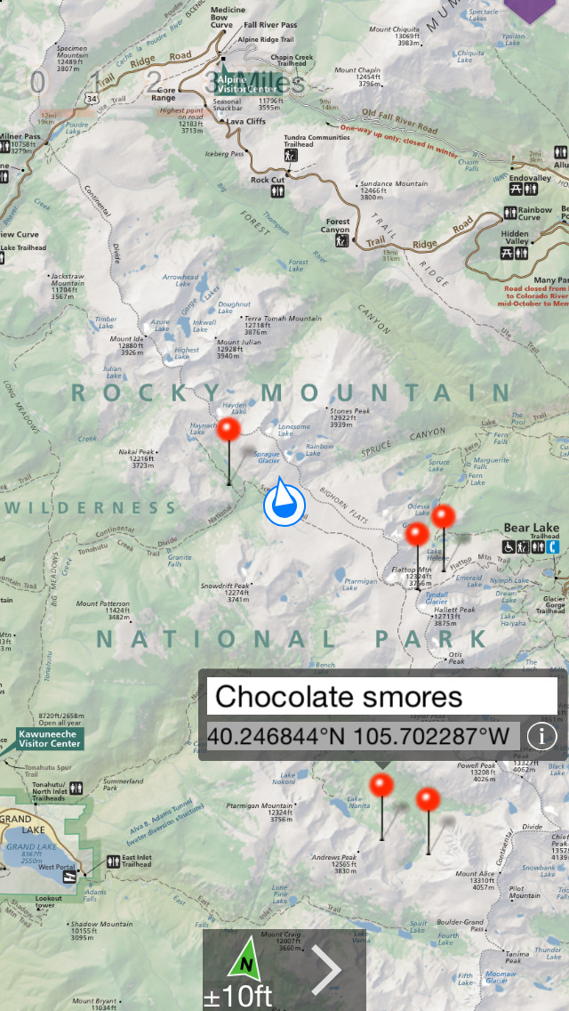
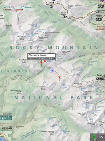
NP Maps Rocky Mtn app offers NPS maps of Rock Mountain National Park, Dinosaur National Monument, Great Sand Dunes, Black Canyon of the Gunnison and Mesa Verde National parks and more for you to see your location on them realtime. Plus, NP Maps Rocky Mtn downloads official US Geological Survey topography maps for the entire United States and the ten US territories.*
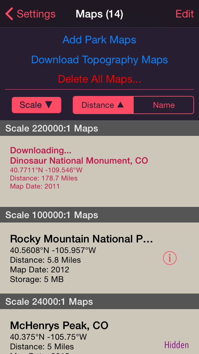
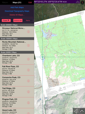
This app is priceless for road trips, hikes, camping, exploring, planning and much more. You can build complete map sets to cover your travel from where you start to the national parks in the entire state of Colorado. Because many of these wilderness regions have no data service, select and download maps now or while online for your travels so you can enjoy using this app as it was intended: no internet connection. And, this app can detect internet service and automatically install USGS topography or NPS map for your current location if not already done.
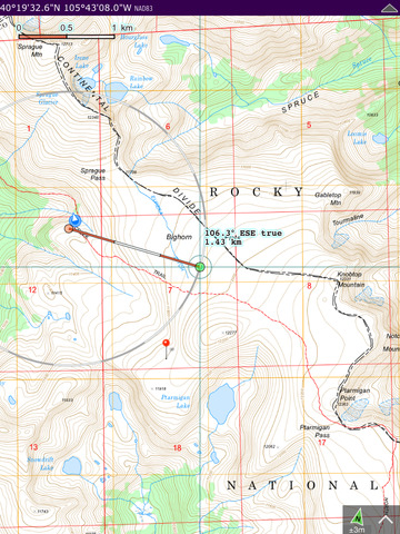
Logical and intuitive to use. Park and topography maps are geospatially integrated with Apple Maps for a familiar interface and for navigating a visual catalog of maps. A marvelous index into an extensive library covering Colorado allows you to select maps for install all with a simple touch along your planned route of travel.
Features:
• Built-in NPS map for Rocky Mountain Nation Park and four(4) USGS and US Forest Service topography
• Access a library of over 67,000+ maps
• Full rendering high resolution maps
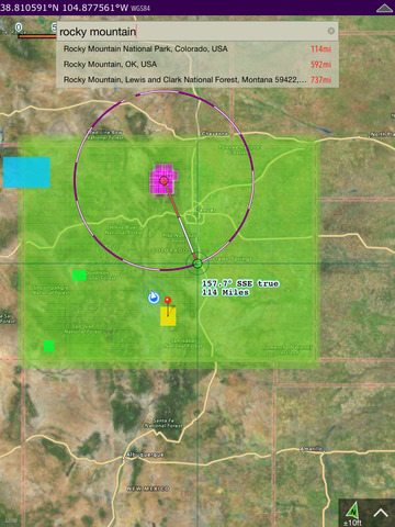
• Find geographic features worldwide with a powerful geo-code search
• Waypoints with Augmented Reality finder
• Route path creation
• Track/bread-crumb GPS path recording**
• Shows your current GPS location**
• Dual mode ruler with orthographic line and path measuring
• Full app usability while maps download in the background
• Footprint grid index with quadrangle names for visual map selection
• Aligns differing map datums to the WGS84/GPS coordinates
• Automatic map download for your current location
• Miles, Feet, Kilometers, Meters, Nautical Miles units
• Latitude and Longitude coordinate display in decimal or arc minutes and seconds
• Import geospatial PDF map files via web, email attachment & iTunes
• Import and export waypoints using GPX format
• Integrated help manual
• Supports rotation and follows heading map orientations
• No need for cellular service to use installed maps
• Subscription covers the cost for internet server access.
* Not preloaded with all maps. WiFi recommended when downloading maps.
** Continued use of GPS running in the background can dramatically decrease battery life.
Some iPad & iPod models do not have GPS and compass hardware required for waypoint AR feature.
iPhone Screenshots
(click to enlarge)


iPad Screenshots
(click to enlarge)

App Changes
- July 31, 2015 Initial release
- August 21, 2015 Price decrease: $1.99 -> $0.99
- August 25, 2015 New version 3.2
- August 25, 2015 Price increase: $0.99 -> $2.99
- August 31, 2015 Price decrease: $2.99 -> $0.99
- September 05, 2015 Price decrease: $0.99 -> FREE!
- September 13, 2015 Price increase: FREE! -> $1.99
- February 27, 2016 Price decrease: $1.99 -> $0.99
- March 05, 2016 New version 4.0
- March 05, 2016 Price decrease: $0.99 -> FREE!
- July 07, 2016 New version 4.3
- November 07, 2016 New version 5.0
- December 22, 2016 New version 5.1
Other Apps From Delcartes LLC