
What's New
- Performance in route/track drawing algorithm.
- Monetization for hosting costs.
App Description
NP Maps - Grand Canyon app displays high resolution official maps from the US National Park Service and US Geological Survey for Arizona on your iPhone and iPad without needing data service*
Logical and intuitive to use. Park and topography maps are geospatially integrated with Apple Maps for a familiar interface and for navigating a visual catalog of maps. A marvelous index into an extensive library covering all of Arizona allows you to select maps for install all with a simple touch along your planned route of travel.
Get complete map coverage for travel in Arizona between parks and where you start in the USA without later need of the internet. Park and wilderness regions may have little or no data service, select and download more maps now or while online.
Features:
• Preloaded with NPS maps of Grand Canyon NP, Parashant National Monument, and two(2) USGS 100K scale topography maps
• Access a library of over 120 NPS and 67,000 USGS topography maps
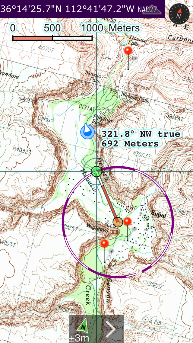
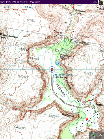
• Full rendering high resolution maps
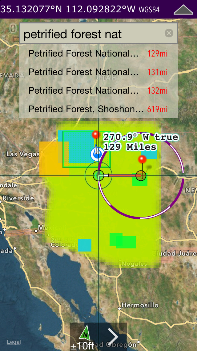
• Find geographic features worldwide with a powerful geo-code search
• Waypoints with Augmented Reality finder
• Route path creation
• Track/bread-crumb GPS path recording**
• Ruler with dual mode orthographic line and path measurements
• Shows your current GPS location and heading reference**
• Full app usability while maps download in the background
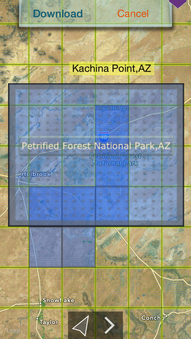
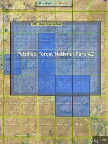
• Footprint grid index with quadrangle names for visual map selection
• Aligns differing map datums to the WGS84 (GPS) coordinates
• Automatic map download for your current location
• Miles, Feet, Kilometers, Meters, Nautical Miles units
• Latitude and Longitude coordinate display in decimal or arc minutes and seconds
• Import geospatial PDF map files via web, email attachment & iTunes
• Import and export waypoints using GPX format
• Detailed integrated help
• Supports rotation and follows heading map orientations
• No need for cellular service to use installed maps
• Subscription to cover internet access costs.
*Not preloaded with all maps. WiFi recommended when downloading maps.
** Continued use of GPS running in the background can dramatically decrease battery life. Some iPad & iPod models do not have GPS and compass hardware required for the waypoints AR feature.
iPhone Screenshots
(click to enlarge)


iPad Screenshots
(click to enlarge)


App Changes
- July 31, 2015 Initial release
- August 04, 2015 Price decrease: $2.99 -> $1.99
- August 21, 2015 Price decrease: $1.99 -> $0.99
- August 24, 2015 New version 3.2
- August 25, 2015 Price increase: $0.99 -> $2.99
- September 01, 2015 Price decrease: $2.99 -> $0.99
- September 05, 2015 Price decrease: $0.99 -> FREE!
- September 13, 2015 Price increase: FREE! -> $1.99
- February 28, 2016 New version 4.0
- February 28, 2016 Price decrease: $1.99 -> FREE!
- March 06, 2016 New version 4.0.1
- July 09, 2016 New version 4.3
- November 08, 2016 New version 5.0
- December 22, 2016 New version 5.1
Other Apps From Delcartes LLC